Beck Hill - Red Cliffs Desert Reserve
Difficulty Level: Moderate
Distance: 5.1 miles (from Chuckwalla Trail - 7.1 miles total)
TRAIL SUMMARY
Stretching along the canyon, Beck Hill features a beautiful landscape that is good for all skill levels. The trailhead is accessed through Chuckwalla trail (1 mi.) next to the Turtle Wall trailhead and is well marked. Consisting of a a single dirt path, the hike is mostly sandy with a steady incline that descends to connect with Paradise Rim and Gila Trail. Along with a great view, Beck Hill is known to have the most tortoise sighting. Many other wildlife is often spotted, specifically hawks, eagles, rabbits, lizards, and roadrunners. Though it is occasionally hiked as part of a loop with Paradise Rim, Beck Hill is a great hike for those looking for a scenic 5 mile hike located near St. George.
TRAIL DETAILS
DIFFICULTY LEVEL
Moderate
ROUND TRIP LENGTH
5.1 miles (from Chuckwalla Trail - 7.1 miles total)
AVERAGE HIKE TIME
GPS COORDINATES
Trailhead: 37.146306, -113.611222
Connection with Paradise Rim: 37.156333, -113.622556
PROPERTY MANAGEMENT
Red Cliffs Desert Reserve
DISTANCE FROM ST GEORGE
4.3 Miles (9 mins driving)
RESTROOM FACILITIES
Vault Toilets at Trailhead
HIKERS ALLOWED
Yes
DOGS ALLOWED
Yes, on 6 ft leash
BIKERS ALLOWED
Yes
EQUESTRIAN ALLOWED
Yes
HIKE TYPE
Out & Back
BEST TIME OF THE YEAR TO HIKE
Spring, Fall, Winter
BEST TIME OF THE DAY TO HIKE
Morning, Evening
GROUP LIMIT
No Limit
PERMIT INFORMATION
No Permit Required
COST
No Cost
WATER SOURCES AVAILABLE
No Water Sources Available
CAMP SITES
No Camping Available on Trail
TRAIL CONDITIONS
Dirt Single Track, Dirt Double Track, Sandy, Rocky
SUN EXPOSURE
Full Sun Exposure


DIRECTIONS TO TRAILHEAD
Directions to parking at Trailhead. Walking directions to Trailhead via Chuckwalla Trail. Trailhead is accessed through Chuckwalla Climbing Area. These directions lead to the parking lot at Chuckwalla, then, direct to Beck Hill Trailhead via Chuckwalla Trail.
From St George, head north on Bluff Street. Keep right towards Enterprise and continue straight as road turns into Hwy 18. In 0.1 miles, immediately take the first left turn onto Country Rd and park. After parking, follow Chuckwalla Trail for 1 mile (about 15 minutes) until Chuckwalla Trail ends at the junction between Turtle Wall and Beck Hill. Beck Hill Trail begins with the path to the right and is well marked.
FLORA AND FAUNA
Plants: Typical plant life for Southern Utah lowland hiking.
Animals: Typical animal life for Southern Utah lowland hiking.
TRAIL REPORT
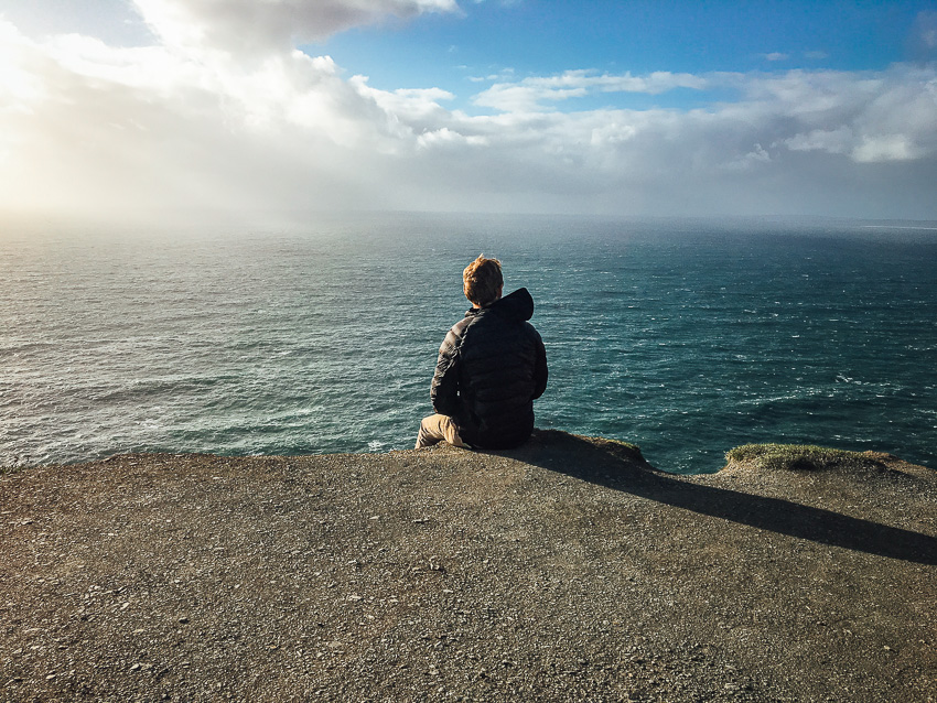
Beck Hill follows a unique path along various rock formations and landscapes. The trail is a mostly sand with a mix of rocks and does not offer any shade. There are noticeable inclines and declines but the path is still good for all levels of hikers. The peak elevation offers a scenic view that is great for pictures. Beck Hill is filled with unique rock formations, diverse wildlife, and flowers.
ABOUT THE AUTHOR
Spencer McMullin
Spencer McMullin is originally from Connecticut but has deep ties to the Southern Utah area. His passion for adventure and photography has lead him to HikeStGeorge.


Leave a Reply
Want to join the discussion?Feel free to contribute!