Silver Rim
Difficulty Level: Moderate
Distance: 6 miles round trip
TRAIL SUMMARY
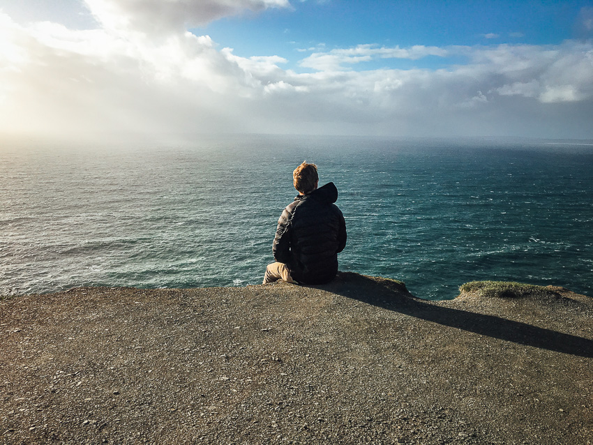
Located right outside of Silver Reef, Silver Rim is the first trail into the Dixie National Forest. The trail is 6 miles round trip and somewhat clear with markings. Most hikers enjoy hiking 1 mile with a 400 feet elevation to a spectacular view which features Quail Lake, Silver Reef, and even a piece of Zion National Park. After this view, hikers can choose to descend and continue down the path deeper into the Dixie National Forest. There are some incredible rock formations along the path and the peaks of Pine Valley Mountain can be seen. After about 2 miles, the path becomes less clear. Overall the full hike is 6 miles round trip but be prepared to almost carve your own path as you go deeper.
TRAIL DETAILS
DIFFICULTY LEVEL
Moderate
ROUND TRIP LENGTH
6 miles round trip
AVERAGE HIKE TIME
GPS COORDINATES
PROPERTY MANAGEMENT
Forest Service, Dixie National Forest
DISTANCE FROM ST GEORGE
20 miles (30 mins driving)
RESTROOM FACILITIES
No Restroom Available
HIKERS ALLOWED
Yes
DOGS ALLOWED
Yes, on 6 ft leash
BIKERS ALLOWED
No
EQUESTRIAN ALLOWED
Yes
HIKE TYPE
Out & Back
BEST TIME OF THE YEAR TO HIKE
Great Year Round
BEST TIME OF THE DAY TO HIKE
Any Time
GROUP LIMIT
No Limit
PERMIT INFORMATION
No Permit Required
COST
No Cost
WATER SOURCES AVAILABLE
No Water Sources Available
CAMP SITES
No Camping Available on Trail, Camping Available only in Designated Camping Area
TRAIL CONDITIONS
Dirt Single Track, Sandy, Rocky
SUN EXPOSURE
Full Sun Exposure


DIRECTIONS TO TRAILHEAD
Directions to Trailhead: From St George, head north on I-15 for about 13 miles and take exit 22 toward Leeds/Silver Reef. Head north on Main Street for about 1.5 miles and turn left on Silver Reef Road. Continue for about 1.2 miles and the road turns into Oak Grove Road. Keep heading toward the hills and you will cross the bridge into Dixie National Forest. Turn right on FR 032 (dirt road) and continue for about half a mile. Trailhead and parking will be on the left.
FLORA AND FAUNA
Plants: Typical plant life for Southern Utah lowland hiking.
Animals: Typical animal life for Southern Utah lowland hiking.
TRAIL REPORT
Coming Soon.
ABOUT THE AUTHOR
Spencer McMullin
Spencer McMullin is originally from Connecticut but has deep ties to the Southern Utah area. His passion for adventure and photography has lead him to HikeStGeorge.


Leave a Reply
Want to join the discussion?Feel free to contribute!