


Leave a Reply
Want to join the discussion?Feel free to contribute!
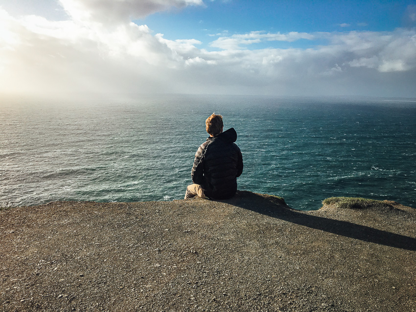
Around evening, Black Brush trail offers some incredible views of the Santa Clara/Ivins area. The trail is located within the Santa Clara River Reserve at the Cove Wash Trailhead. The path is clear and well marked. After one mile, the path spilts into a 2.2 mile loop. Though the map below shows proceeding to the right, it might be easier to go left at first as the incline is easier from that direction. Near the center of the loop are signs indicating unique rock formation and even some rock art. The rock art is not too clear but a few petroglyphs can be seen on the cliffside across the gulch. Explore with caution as diverting from the path may lead to a steep cliff.
Overall, Black Brush is easy to moderate trail that offers a great view of the great St. George area. The entrance to Snow Canyon can be see as well. Horse riding is common on the path and the trail is dog friendly. Please be cautious of rattle snakes that often hide under brush and in rock cavities.
Moderate
4.2 miles round trip
BLM, Santa Clara River Reserve
7.5 miles (20 mins driving)
No Restroom Available
Yes
Yes, on 6 ft leash
No
Yes
Out & Back
Great Year Round
Any Time
No Limit
No Permit Required
No Cost
No Water Sources Available
Dispersed Camping Available
Dirt Single Track, Dirt Double Track, Rocky
Full Sun Exposure
Cove Wash Trailhead – From I-15 Exit 6 turn north on Bluff Street. Turn left on Sunset Blvd. Continue on Sunset Blvd as it turns into Santa Clara Drive. Turn left on Gates Lane (just before reaching the Jacob Hamblin Home on the right). Cross the river and at 0.4 miles turn left (leaving the pavement). Note that the road from this point is steep and rocky, and can be eroded. At 0.7 miles turn right (at sign for Reserve). At 0.7 miles turn right (at sign for Reserve). Pass the water tank, and at 1.3 miles turn right (at sign for reserve). Follow the road around to the left and park in the trailhead at 1.5 miles.
The link will only direct to Clary Hills Dr. From there, enter dirt road and follow directions about until Cove Wash Trailhead. The dirt road is rocky and may not be suitable for all vehicles.
Plants: Typical plant life for Southern Utah lowland hiking.
Animals: Typical animal life for Southern Utah lowland hiking.
Coming Soon.
Spencer McMullin is originally from Connecticut but has deep ties to the Southern Utah area. His passion for adventure and photography has lead him to HikeStGeorge.

 Fishhook – Santa Clara River Reserve
Great trail. Pretty easy to follow – we turned left at the fork, and took in the Santa Clara river views on the way back. Very quiet trail – we only saw one other group at the start of the trail.